Technology to Look at All Global Navigation Satellites

Sitting in a parking lot, booting up a navigation system and waiting for the ol’ hour glass to stop and get a fix on the satellites can be a frustrating thing. The name of the game is Time to First Fix (TTFF) where the radio receiver can get a signal from the satellites in view (line-of-sight), and triangulate the signal.
With line-of-sight in mind, global navigation systems radio signals are impeded by obstructions like large buildings, commonly referred in navigation parlance as ‘urban canyons’, forest canopies, parking garages/indoors, and noisy RF environments. All of these can keep a navigation receiver from being able to receive these signals or significantly delay reception.
Enter STMicroelectronics’ Teseo-LIV3F Global Navigation Satellite System (GNSS) module and its associated evaluation board.
More is always better is the case for the number of satellites being received at a given time.
Newer GNSS systems can receive satellite systems from a number of global navigation systems.
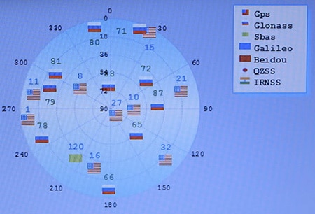
ST’s Teseo-LIV3F module is standing out from the crowd as it’s pulling in concurrent satellite signals from an impressive number of global standards: GPS, Glonass, Galileo, QZSS, and BeiDou.
 STMicroelectronics’ Teseo-Suite PC software for visualization and development of Teseo GNSS family. (Image source: STMicroelectronics)
This is a feature called simultaneous multiconstellation, and this is an extreme advantage over modules that only utilize a system like GPS or have a limited number of systems they can receive concurrently.
There are other ways to mitigate a low number of satellites reception from weak or partial signals.
The Teseo-LIV3F allows for Autonomous Assisted GPS. So, for devices that offer network availability such as mobile GSM, the ability to tap into publicly available databases for satellite positions and predicted future positions means the ability to take the first few available signals and extrapolate current position based on the information available. This takes much of the processing work of triangulation math and waiting for further signal reception off the device. This translates to fast Time to First Fix. This IS pretty much rocket science, but developers need not be concerned, ST’s module and development environment do all the heavy lifting for you.
As users demand more and more features from their handhelds, space is at an extreme premium in the mobile device market, and for aerial vehicles, weight. At an extremely compact 9.7 x 10.1 mm (0.38 x 0.39 in.) this is another area where this device is standing out.
There are inevitable times when reception isn’t possible due to physical limitations. Tunnels, indoors, previously described urban canyons, and in noisy RF environments, that’s where ‘dead reckoning’ comes in.
Having taken a look under the hood of ST’s libraries and development environments, I noticed they allow for ease of tapping into their line of gyros, accelerometers, and Inertial Measurement Units to enable the measurement of the device’s physical positioning relative to space, allowing the device to keep the map moving in times of radio blackouts.
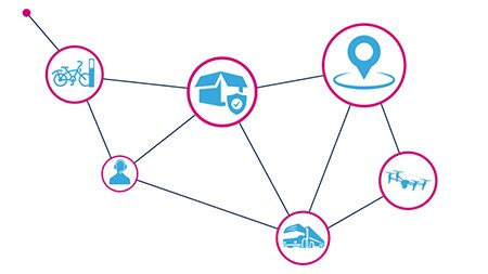
 (Image source: STMicroelectronics)
Along the lines of ease of development, ST is hitting the ground running launching this module simultaneously with a Nucleo ecosystem development expansion board, featuring the Arduino form factor shield compatible header connectors.
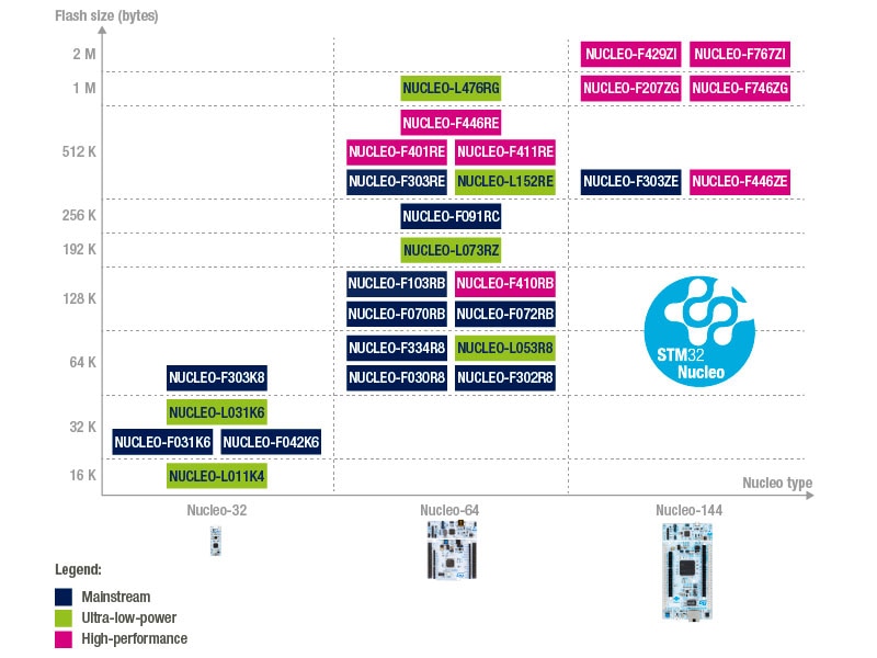
This expansion board is recommended for use with NUCLEO-F401RE, NUCLEO-L476RG or NUCLEO-L073RZ boards from the STM32 Nucleo family of development boards.
Also available for expedient out-of-box success for this development shield is ST’s X-Cube-GNSS1 software expansion for STM32Cube.
Accenting this development board is STMicroelectronics’ GNSS PC development tool, TESEO-SUITE, that assists in visualization, management, configuration and evaluation of the navigation receivers, which allows for features like firmware reconfiguration and future firmware upgrades.
As for the mobile market’s tools for rapid development, ST has AndroidHAL-Teseo, an Android Hardware Abstraction Layer device driver for TESEO GNSS solutions.
It's an exciting time to be a mobile phone, tablet, autonomous aerial vehicle, or fleet tracking designer; or for that matter, a user of these devices.

Have questions or comments? Continue the conversation on TechForum, DigiKey's online community and technical resource.
Visit TechForum


